The IF800 NDAA-Compliant Photogrammetry Kit is built for surveyors, engineers, and geospatial teams who need high-accuracy mapping workflows with a secure, compliant aerial system.
Built around the IF800 platform and powered by the Sentera 65R with an RTK/PPK module, this kit delivers precise image capture for orthomosaics, topographic mapping, and 3D reconstruction. It’s a proven configuration designed to produce reliable datasets and support high-accuracy photogrammetry workflows in the field.
Not sure if this is the right setup for your workflow? Talk to an expert to configure the right mapping system for your operation.
What’s Included
- IF800 Aircraft
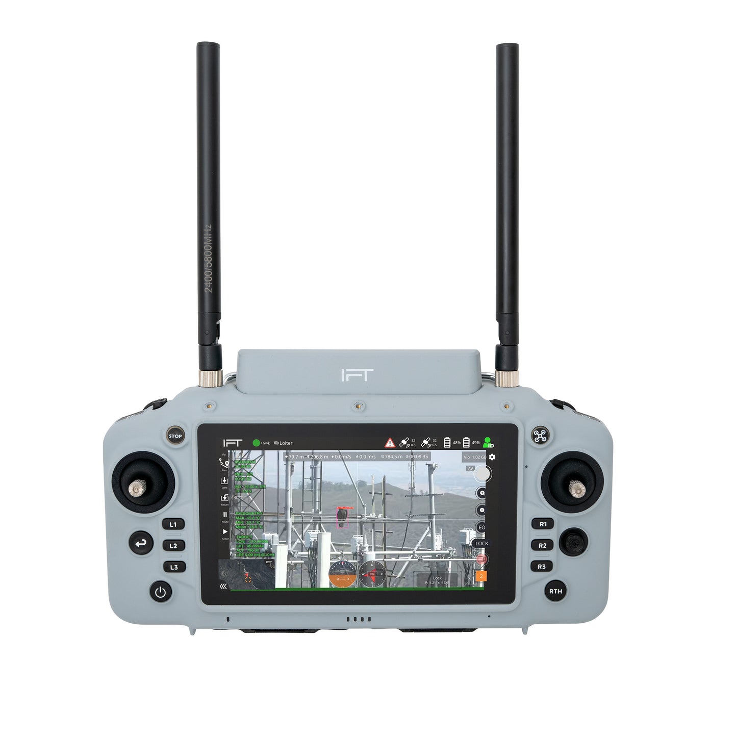
- GS-One Ground Controller
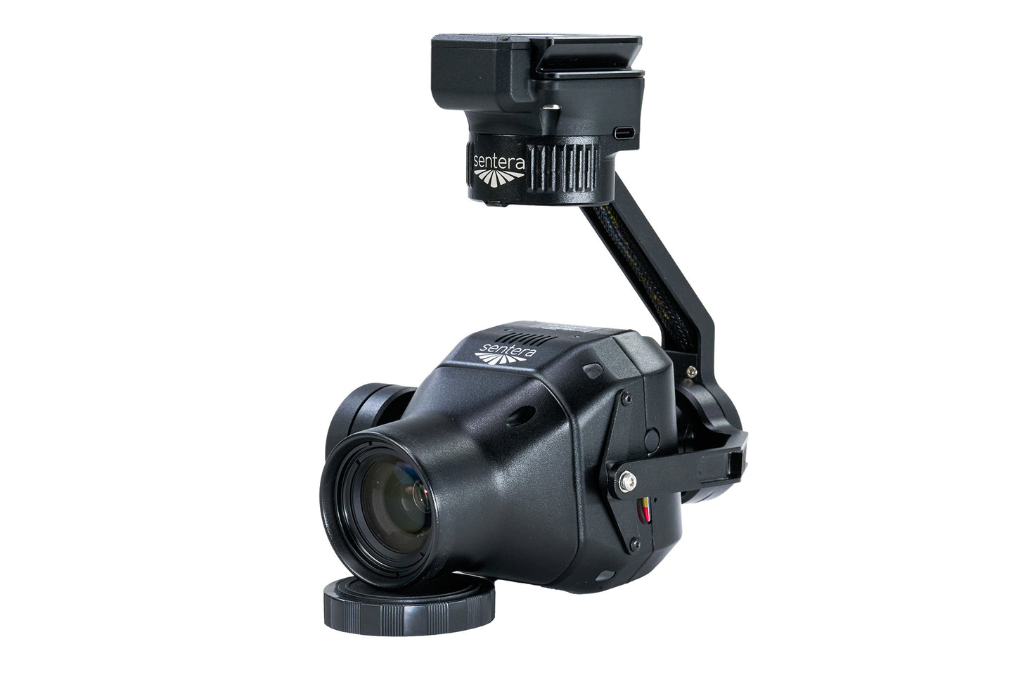
- Sentera 65R High-Resolution Mapping Payload
- Sentera RTK/PPK Module
- IF800 Battery Kit (4 Batteries + 2 Chargers)
- Additional 2 IF800 Smart Batteries + 2 Chargers
- Rugged Transport Case
- Inspired Care Elite Coverage
- Travel Expense Coverage for Training / Support
Key Features
High-Resolution Photogrammetry with Global Shutter
The Sentera 65R features a 65 MP sensor with a global shutter, enabling distortion-free image capture for accurate photogrammetry and mapping workflows.
RTK/PPK-Enabled Mapping Workflows
The included RTK/PPK module supports precise geotagging and improved positional accuracy, reducing reliance on ground control points and streamlining data collection.
Designed for High-Accuracy Mapping Projects
Capture consistent datasets suitable for orthomosaics, surface models, and detailed mapping deliverables across a range of environments.
All-Day Power for Field Operations
With 6 total batteries and 4 chargers, this kit supports long mapping sessions, minimizing downtime between flights and keeping your team productive on-site.
GS-One Ground Control System
High-brightness display with integrated controls for reliable operation in outdoor environments, supporting mission planning, live telemetry, and image capture workflows.
Stable Flight Performance with Mapping Payloads
Delivers consistent image capture and reliable datasets across each mission, even during large-area or repeat flight plans.
Ready-to-Deploy Photogrammetry Workflow
Fully integrated system designed to reduce setup complexity and accelerate deployment in the field.
Field-Ready Transport
Rugged case keeps your system protected and organized for deployment in demanding environments.
Elite Training + Support Coverage
Includes Inspired Care Elite with travel support, helping your team get operational quickly with hands-on training and ongoing assistance.
Applications / Use Cases
- Land Surveying and Mapping
- Construction Site Progress Tracking
- Topographic Mapping
- Earthworks and Volume Calculations
- GIS Data Collection
Integration with Inspired Flight
Fully integrated with the IF800 platform, this system delivers a seamless photogrammetry workflow. NDAA-compliant and built for organizations that require secure, reliable aerial mapping solutions.
Why This Kit
This kit provides a high-accuracy photogrammetry solution with a proven aircraft and payload configuration. It reduces integration complexity, improves data reliability, and supports efficient mapping workflows from capture through processing.